Xinjiang · Xinjiang

Xinjiang Tours & Travel Guide 2026 | Kashgar, Urumqi, Silk Road | JoyoTour

Xinjiang is China's far west — Kashgar's Silk Road bazaar, the Taklamakan desert, Tian Shan lakes and the gateway city of Urumqi. Private Xinjiang tours from US$209 a day.

The short version

Xinjiang is China's largest region — 1.66 million km², roughly one sixth of the country — and the desert half of the Silk Road. You reach it through its capital, Urumqi, then head west to Kashgar and south to the Taklamakan. Ten days is the honest minimum; eight works if you fly between Urumqi, Kashgar and Turpan instead of driving.

XinjiangProvince
May–June and September–OctoberBest months
URCAirport
YesDaily intl. flights
Prefer it arranged for you? Snow peaks, grassland, desert and oasis — one-sixth of China, and the longest road you will ever ride. Xinjiang travel guide →

The place itself

What Xinjiang is actually like

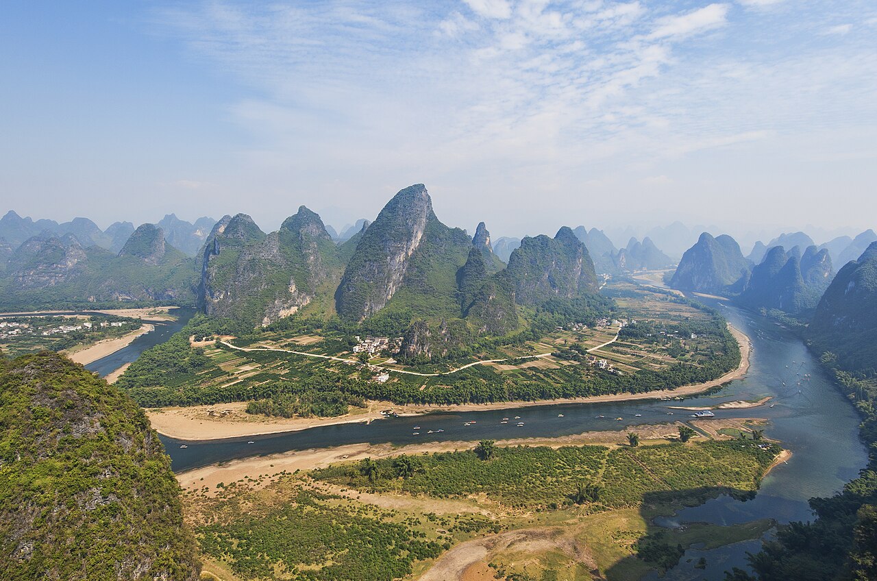
Xinjiang is not a place you pass through. It is larger than France, Germany and Spain combined, and until you have driven a full day between two of its towns you have not understood the scale of it. The Taklamakan — the second-largest sand desert on Earth — fills the middle, and the Tian Shan mountains cut across it in a line of 5,000 m peaks.

This was the middle section of the Silk Road. Kashgar's old town was the last major trading city before the Karakoram passes, and the Id Kah Mosque, the Sunday livestock market and the craft workshops still run on that history rather than on a re-enactment of it. Urumqi, by contrast, is a modern city of three million built on oil, coal and cotton, and it is where nearly every trip starts.

Logistically Xinjiang behaves like a small country. Distances are measured in hundreds of kilometres, the police checkpoints are routine and often slow, and a day that looks short on the map regularly runs long. That is the argument for going with a driver-guide who knows which roads are open and where the good Uyghur kitchens are — not because the region is difficult, but because it is big.
75°E75°E90°E90°E105°E105°E120°E120°E135°E135°E20°N20°N30°N30°N40°N40°N50°N50°N ChangchunKashgar BeijingBeijingXi'anXi'anShanghaiShanghaiChengduChengduGuilinGuilinHangzhouHangzhouZhangjiajieZhangjiajieTibet · LhasaTibet · LhasaYunnan · KunmingYunnan · KunmingSichuan · ChengduSichuan · ChengduQinghai · XiningQinghai · XiningGansu · LanzhouGansu · LanzhouXinjiang · UrumqiXinjiang · UrumqiInner Mongolia · HohhotInner Mongolia · HohhotGuangzhouGuangzhouShenzhenShenzhenHarbinHarbinDalianDalianShenyangShenyangChangbai MountainChangbai MountainKunmingKunmingDaliDaliShuheShuheLijiangLijiangXiamenXiamenGulangyuGulangyuFuzhouFuzhouLugu LakeLugu LakeXishuangbanna · JinghongXishuangbanna · JinghongShangri-LaShangri-LaNanchangNanchangHefeiHefeiHongcunHongcunWuhanWuhanChangshaChangshaFenghuang Ancient TownFenghuang Ancient TownLushanLushanWuyuanWuyuanMount Heng (Hengshan, Hunan)Mount Heng (Hengshan, Hunan)HuangshanHuangshanWudang MountainWudang MountainLuoyangLuoyangYuntai MountainYuntai MountainRizhaoRizhaoYantaiYantaiLianyungangLianyungangSanqing MountainSanqing MountainTianjinTianjinDatongDatongTaiyuanTaiyuanPingyaoPingyaoWutai MountainWutai MountainHulunbuir · HailarHulunbuir · HailarThe Forbidden CityThe Forbidden CitySanyaSanyaHaikouHaikouBeihaiBeihaiNanningNanningGuangxi · NanningGuangxi · NanningHuizhouHuizhouZhuhaiZhuhaiWuyi MountainWuyi MountainBeidaiheBeidaiheShanhaiguanShanhaiguanBaiyangdianBaiyangdianQinhuangdaoQinhuangdaoYesanpoYesanpoJiuzhaigouJiuzhaigouMount SiguniangMount SiguniangHailuogouHailuogouDaocheng YadingDaocheng YadingShunan Bamboo SeaShunan Bamboo SeaDujiangyanDujiangyanQingcheng MountainQingcheng MountainQingdaoQingdaoMount TaiMount TaiJinanJinanWeihaiWeihaiQufuQufuPenglaiPenglaiChangdaoChangdaoNanjingNanjingSuzhouSuzhouZhouzhuangZhouzhuangTongliTongliWuxiWuxiYangzhouYangzhouZhenjiangZhenjiangChangzhouChangzhouWuzhenWuzhenXitangXitangXixi WetlandXixi WetlandNingboNingboMount PutuoMount PutuoQiandao LakeQiandao LakeShaoxingShaoxingZhoushanZhoushanHengdianHengdianYandang MountainYandang MountainZhejiang · HangzhouZhejiang · HangzhouHong KongHong KongHong Kong Outlying IslandsHong Kong Outlying IslandsHong Kong ShoppingHong Kong ShoppingMacaoMacaoTaipeiTaipeiKaohsiungKaohsiungTaiwan · TaipeiTaiwan · TaipeiUrumqiUrumqiNorth Xinjiang · UrumqiNorth Xinjiang · UrumqiQinghai LakeQinghai LakeMount EmeiMount EmeiLanzhouLanzhouMount HuaMount HuaDunhuangDunhuangGannan · LanzhouGannan · LanzhouSichuan–Tibet Highway (G318) · Chengdu (CTU)Sichuan–Tibet Highway (G318) · Chengdu (CTU)KangdingKangdingLhasaLhasaNyingchiNyingchiNamtsoNamtsoChongqingChongqingQiandongnan · GuiyangQiandongnan · GuiyangLiboLiboGuiyangGuiyangZhenyuanZhenyuanHuangguoshuHuangguoshu
Destination — click to open the guide Province or autonomous region Provincial capital Major river

Pins are plotted from real latitude and longitude on a 5° graticule. This is a schematic orientation diagram, not a political map — no boundaries are drawn.

What not to miss — Xinjiang

01

Kashgar and the Id Kah Mosque

The Id Kah is China's largest mosque, and the old town around it is a warren of adobe lanes, copper-smiths and bread ovens. The Sunday livestock and crafts market just outside the city is the single best reason to be here on a weekend.

02

Karakul Lake and Muztagh Ata

A 3,600 m lake on the Karakoram Highway with 'Father of Ice Mountains' rising straight out of it to 7,509 m. Kyrgyz herders rent out yurts on the shore; the drive from Kashgar takes about four hours.

03

Turpan and the Flaming Mountains

A depression 154 m below sea level, the hottest place in China, and the karez — a 2,000-year-old gravity irrigation network of underground channels that turned this basin into vineyards.

04

Heavenly Lake of the Tian Shan

Tianchi, 1,980 m up in the mountains an hour and a half from Urumqi. Boat the lake in the morning, walk the forest rim in the afternoon.

05

Kanas Lake and Hemu village

Far north on the Kazakh and Mongolian borders — cold, birch-forested and impossibly clear. Late September, when the larches turn, is the week to plan around.

06

The Taklamakan and the Tarim Basin

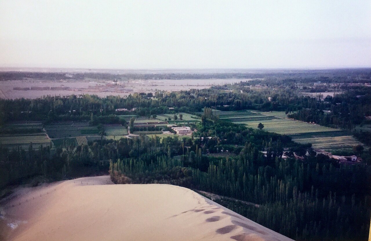
Dune fields where the desert road runs for over 500 km (310 mi) with no town in between. Sunset from the top of a dune, with nothing else in any direction.

China tours that include this stop — Xinjiang

14 days · Culture

Silk Road Odyssey

Xi'an to Dunhuang along the Hexi Corridor: desert fortresses, camel treks at Mingsha Shan and the caves of a Thousand Buddhas.

★★★★★4.8 76 reviews

From US$2,690/per person

View tour

Getting there and away

Urumqi Diwopu International Airport (URC) is the entry point, with direct flights to Almaty, Bishkek, Tashkent, Moscow, Islamabad and Istanbul, plus frequent domestic connections to Beijing, Shanghai, Chengdu and Guangzhou. From Beijing the flight is about 4h 30m.

The Lanzhou–Xinjiang high-speed line links Urumqi to Turpan in an hour and to Lanzhou in about nine, so Xinjiang connects to the rest of the rail network without flying. For long internal hops — Urumqi to Kashgar especially — a 2-hour flight beats a 16-hour train every time.

Inside the region we drive. Every leg is in a private vehicle with a driver, partly because the distances are enormous and partly because a driver who knows the checkpoints and the road conditions saves you whole hours.

Best time to visit — Xinjiang

MonthWeatherCrowdsVerdict
January4°C / -4°C · dry, coldQuietAvoid
February6°C / -1°C · dry, coldVery busyAvoid
March14°C / 5°C · dry, coldModerateGood
April21°C / 12°C · clear and mildModerateBest
May27°C / 18°C · clear and mildBusyBest
June31°C / 23°C · hot, humidModerateOK
July32°C / 25°C · hot, humidBusyOK
August30°C / 24°C · hot, humidBusyOK
September26°C / 19°C · clear and mildModerateBest
October20°C / 12°C · clear and mildVery busyBest
November12°C / 4°C · dry, coldQuietGood
December5°C / -2°C · dry, coldQuietGood

How many days do you need?

Ten days for the classic loop: Urumqi and Tianchi (2), Turpan (1), the flight west to Kashgar with the old town and the Sunday market (3), the Karakoram Highway to Karakul Lake (1), then Hotan or the Taklamakan crossing on the way back (2), plus travel days. Add four or five days for Kanas in the far north — it is a separate trip and worth its own week.

Plan these days properly

Frequently asked questions

What is the best time to visit Xinjiang?

May to June and September to October. Spring and autumn give 20–28°C (68–82°F) in the basins and clear mountain roads. July and August push Turpan above 40°C while Kanas is at its best; winter closes the northern passes and the Kanas road entirely.

How do I get to Xinjiang?

Fly into Urumqi Diwopu (URC) — about 4h 30m from Beijing and 5h from Shanghai, with direct routes from Central Asia, Moscow and Istanbul. From Urumqi, high-speed rail reaches Turpan in an hour and Lanzhou in nine; Kashgar is a 2-hour flight west.

Is Xinjiang safe and easy to travel in?

It is heavily policed and, in practice, orderly. Standard security checks apply at stations, hotels and some road crossings, so carry your passport at all times and allow extra time. Travelling with a local driver-guide is the difference between a smooth trip and a slow one.

How far apart are the main places?

Very. Urumqi to Kashgar is 1,470 km as the crow flies — a 2-hour flight or a 16-hour overnight train, never a day trip. Urumqi to Turpan is 180 km and one hour by high-speed rail. Kanas is a further 700 km north of Urumqi.

Do people speak English in Xinjiang?

Rarely outside the international hotels in Urumqi. Mandarin works in the cities; Uyghur is the everyday language in Kashgar's old town. Our guides handle all of it, including the markets where prices are negotiated.

Tell us your dates.
We'll do the rest.

Free itinerary design, a revised plan within one working day, and nothing charged until you approve the final version.

  • Free itinerary planning by a destination specialist
  • A revised draft within one working day
  • Nothing is charged until you approve the final version.

No spam. No sales calls. Just a real itinerary from a real person.